Your charts are only as good as an areas last hydrographic survey. In some parts of the world, even the best charts cannot be fully trusted and, although not recommended as a navigation tool, good satellite imagery can prove useful when planning the best route in difficult areas.
This year we decided to visit Belize; a country famous for being a world class dive and snorkelling destination, but notorious among boaters for poorly surveyed charts and tricky navigation. In our first few days here we discovered why it had this reputation.
A close encounter
On a short (dare I say routine) trip from Lark Cay to Hideaway Cay, while sailing in 20+ meters of water, we noticed our depth gauge suddenly jump to show just a couple of meters under our keel. After a short moment of panic, and a sharp turn to starboard to avoid what was now clearly a reef, we managed to get back on track in safe water. Feeling a little shaken we double checked our charts and could find no obvious marks showing anything dangerous; just the ubiquitous obstruction warning – which in our experience at this kind of depth is usually only relevant to large ships… the depth recorded on the chart at the point we made our diversion was 20 meters. Nevertheless, a lesson learned: always keep an eye forward!
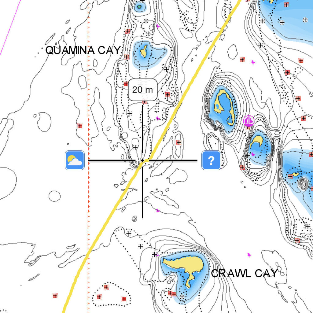
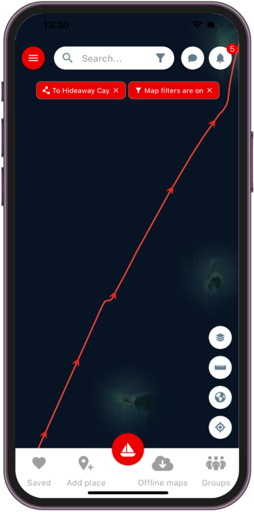
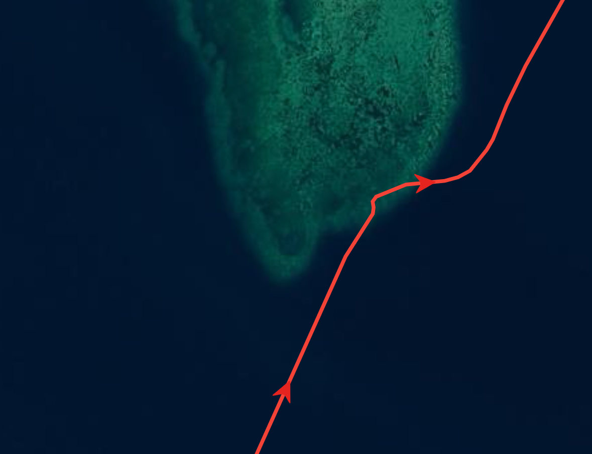
When this happened, we were recording our track on the noforeignland app, and had the satellite view on. Sadly this didn’t show anything useful either. You can see the kink in our recording where we made the sharp alteration in course, but no obstructions are evident:
Finding our way
On the noforeignland website, we offer an option to show satellite imagery from NASA. We checked there and found that it was a bit of a game changer. The reef we almost said “hello” to was very clearly visible, and other areas that we had yet to pass through could also be seen in much more detail.
We kept a close eye out for changes in water colour and referred to the NASA imagery as we completed our trip. Once we had made it safely to our anchorage I fired up my laptop and started writing code to add NASA satellite imagery to the next version of the noforeignland app. And, after a couple of days’ work, here it is. Switching to NASA imagery makes it perfectly clear where the obstructions were on our course:
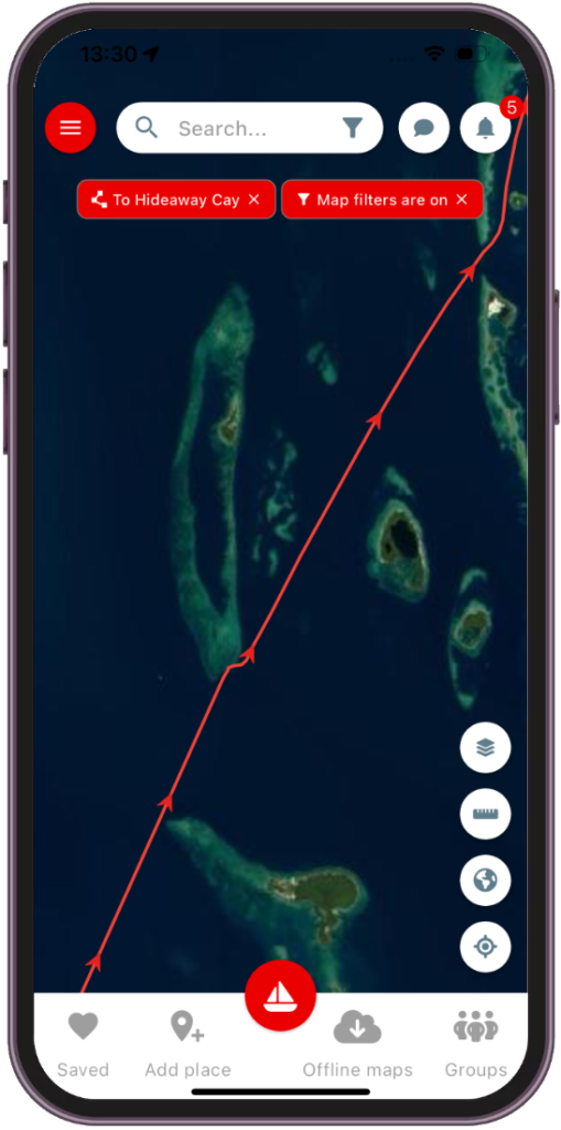
When comparing the last two screenshots, it is clear that the NASA imagery was far more useful to us than the Open Street Map (OSM) satellite layer. In some areas you might find that OSM offers better imagery. In either case, the noforeginland app now offers a choice so you can select the satellite imagery that works best in your sailing area.
What are the limitations of the new map layer?
I have noticed that the higher resolution NASA images take a little longer to download than OSM, and zoom levels are restricted. However, in this part of the world, zooming in on our track shows more than enough detail.
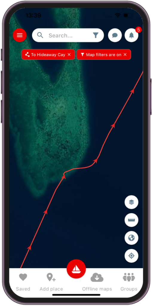
To give you an idea, here’s a zoomed in closeup of that reef we narrowly avoided:
Navigating by satellite imagery
Please remember noforeignland is a destination guide not a navigation tool. We have not added this imagery as an aid to navigation, and certainly wouldn’t recommend it. Your charts and pilot books will give you the best information on where to point your bow. That said, more information is certainly better than less, and we hope that this might occasionally help someone else avoid a similarly close call.
What are your thoughts on using satellite imagery to help plan a course? Are you sailing in a part of the world where this is essential, or would you never consider using it? Please comment below and let us know your thoughts.
If you don’t yet have our app, or cannot see the NASA satellite layer, then you can download the latest version for free here.




Steve, thanks for the new changes to the NASA imagery. We are currently in San Blas Islands, Panama and the sat imagery is a great additional assistance to getting around this huge group of islands, cays and reefs. The GPS charts of the area are not good for entering the many anchorages. The sailing guide by Eric Bauhaus is very informative and useful but a bit difficult to use for anchorage but essential for this area. In the end “Eye Ball mark 1” and good sunlight is the way to go assisted by all the other offerings.
I find the satellite maps useful for identifying sea weed and sand when anchoring. thanks for adding the NASA imagery in the app!
Thanks for the article! Never knew!
We routinely use OpenCPN with MBTILES satellite imagery for the areas that we’re cruising in. The satellite imagery comes from a Windows application called SAS Planet – it provides access to tens of live satellite imagery providers as well as a number of marine chart providers. With our Starlink connection we can view this live (with a gps feed) on the monitor as we enter a new area. So we typically have three screens: chart plotter with Navionics, laptop with OpenCPN (CMaps and previously downloaded satellite images) and a laptop with SAS Planet showing the most clear satellite imagery (when Google and Bing have clouds or glare, Yandex or ArcGIS show clearly) for the area we’re in. We also run several phone apps (iSailor, Zulu Waterways and NFL) and the new NASA imagery may make NFL the go-to phone app for satellite navigation. Thanks!
We’re currently in Indonesia and the various chart solutions (Navionics, CMaps, Transas, etc.) are often offset by several hundred metres and just don’t show enough (or any) details. Satellite imagery is a must in this area.
Wow – that’s a lot of information to digest 🙂 Glad to hear you’re finding NFL useful. Let us know how you get on with the NASA layer over the next few weeks!
yes agreed. We are also in Indonesia and have found many times that obstacles, islands and hazards are at some distance from their charted positions.
Sounds like you are more skilled with Open CPN and other satellite sources than we are. If you see a green (ahem Aqua Mist) Catamaran around, Saoirse, I would happily have you over to give you a beer or two to help show me some Open CPN tricks.
Thanks Neil for the NASA feed update, that potentially makes it more simple if I have a mobile connection.
It’s also possible to upload the SASPlanet tiles as AT5 files to B&G plotters, which is awesome (if a little fiddly 😉 )
The NASA overlay is awesome! Used it yesterday to navigate a cut in the TCI. Navionics and other tools showed channel markers, but only two survived the last hurricane. The NASA overlay is always on now in shallow water navigation. Thank you!
You’re very welcome. Please be careful when using it for navigation. We’ve found it equally useful in similar circumstances but Helena is always up at the bow with polarized glasses to check the way ahead is clear.
Sailing around the world for now 6 years, we appreciate the avaibility of satellite imagery. It was and is still is very usefull in many remote locations we went!
I am very happy about this possibility on NFL. We have been sailing in Fiji waters and Hit a reef, which was not charted and also not visible on OpenCPN pictures. NASA photos show it.
Thanks for your great supportive work!