A successful passage through the Straits of Gibraltar requires a careful balance between wind, tides, currents and, more recently, avoiding encounters with orcas.
The Straits is only 8NM wide at its narrowest point and connects the Atlantic Ocean to the Mediterranean Sea. This gateway is therefore one of the busiest waterways in the world and a tricky body of water to navigate.
In this article we summarise the wealth of knowledge available on transiting the Straits. We will cover the key challenges for sailboats, and describe well-proven strategies for successful east- and westbound passages.
Choose the best time to go
Picking a day and time with the right amount of wind, in the right direction and the right tidal stream is crucial for a smooth passage.
Whenever wind opposes currents, things can quickly become very uncomfortable, and the Straits are no exception. Although their reputation is well deserved, it can often be attributed to impatient sailors who have paid the price for a rushed departure by spending hours bashing into heavy seas.
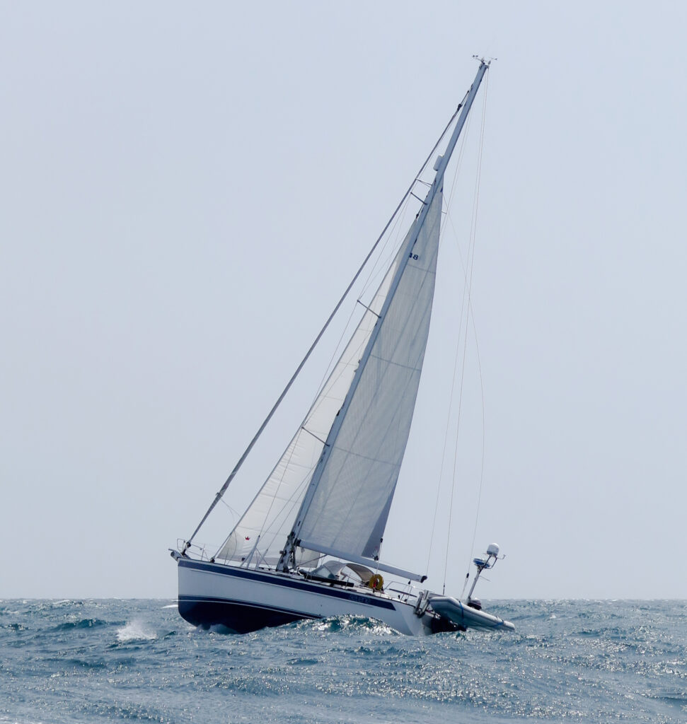
There are many factors to consider when transiting the Straits, these will include: wind strength, tides and currents, traffic, and as if that weren’t enough: orca activity.
Winds in the Straits
Because the strait is so narrow and steep-sided, the wind direction is generally either from the east or west. Be aware that whatever wind there is, it funnels through the Straits and at Punta de Tarifa, commonly making it two to three notches higher on the Beaufort Scale than forecasts might indicate.
The key thing is to avoid any days with a strong wind forecast. In fact, the best advice I heard is to leave with a nearly windless forecast and you will get enough wind to sail.
The prevailing winds that blow through the Straits of Gibraltar are the Levante and Poniente:
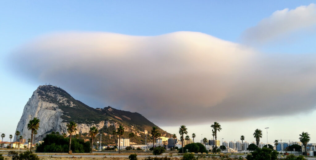
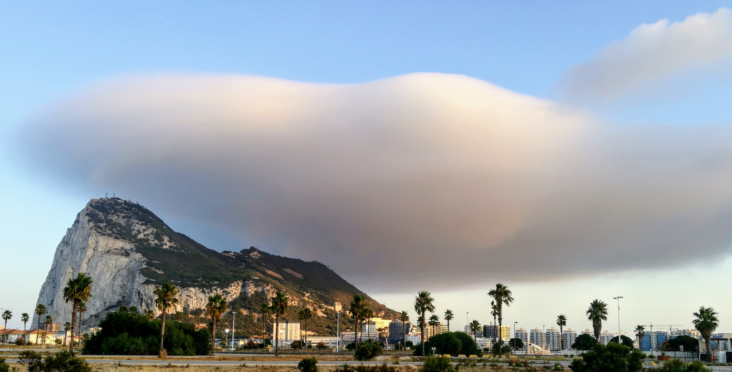
Levante: (or Levanter) blows from the east and is the predominant wind in the summer months (May to September). It brings warm and humid conditions. When a Levante is blowing, you will see a persistent cloud hanging over the top of the Rock. Sea fog is not uncommon on these occasions too. Choose a Levante to sail west out to the Atlantic Ocean
Poniente: this wind comes from the Atlantic Ocean. It is a warm and dry westerly or north westerly wind that brings hot, clear and mostly dry weather. These winds are more frequent from October to April. This is the perfect weather for sailing East into the Mediterranean Sea.
Tides and currents
The Straits mark the boundary between two large bodies of water, so tides and currents are understandably complex.
Just as the narrow strait funnels the winds, it also funnels currents. And, because the water in the Atlantic is less salty and less dense than water in the Mediterranean, a surface current flows continually eastwards into the Med at about two to three knots. Combine this with the effect of the Atlantic tides, and you have a recipe for some of the most complicated tidal patterns in the world.
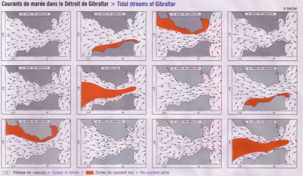
Invest in a Tidal Stream Atlas. These are available from Admiralty Hydrographic publications, and can also be found in many good quality pilot books of the area. A Tidal Stream Atlas provides pictorial representations of tidal stream directions and rates for each hour before and after high water at Gibraltar (HW-GBR), showing expected currents, and locations of known eddies. These simple booklets will make your job as skipper and navigator much easier.
Obtaining forecasts
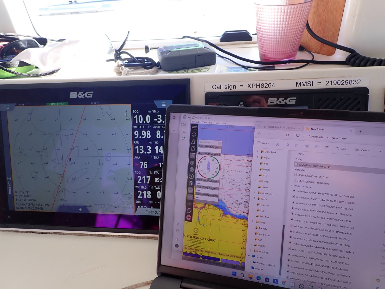
There are many free weather forecast websites and apps available. Choose one that offers an ECMWF weather model as this is generally considered the best medium range forecast for the Straits
Tarifa Radio broadcasts weather reports in English on VHF 10 every two hours. Sometimes they are a bit late, so be patient.
Knowing the time of high water at Gibraltar is pretty straight-forward. There are numerous tide sites available where you can quickly look this up. A personal favourite of ours is WorldTides.info.
Shipping traffic
Around three hundred commercial ships a day pass through the Strait. Unless you are crossing the shipping lanes, you should have no reason to get close to any of them. Stay well clear of the lanes if possible, and if you do need to cross them, stay alert and once inside a Traffic Separation Scheme (TSS) maintain a heading of 90º to the direction of the lane.
Orca encounters
In recent years, orca encounters have made this passage even more treacherous.
Current research indicates that pods of orcas follow migrating tuna. This results in them gathering in the Straits from early spring and throughout the summer. Come September, the orcas follow the migrating tuna north along the Portuguese coast.
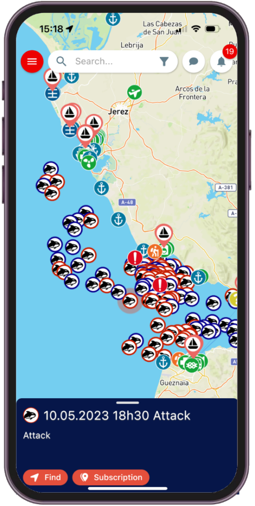
When adult orcas dive to hunt for tuna, the young stay close to the surface. In recent years, the young orcas have kept themselves occupied by playing with the rudders of small boats, causing a huge problem for those sailing here. The best strategy for dealing with the orcas is to stay informed of recent activity and heed expert advice.
At the time of writing, orcas.pt are advising small craft to keep within the 20m depth contour, where very few interactions have been recorded. Orcas.pt also offer a popular Telegram group for yachts in the area where live updates can be shared. Their extensive orca encounter reports can also be loaded into the noforeignland app and accessed without an internet connection while out sailing:
Eastbound transit – entering the Mediterranean
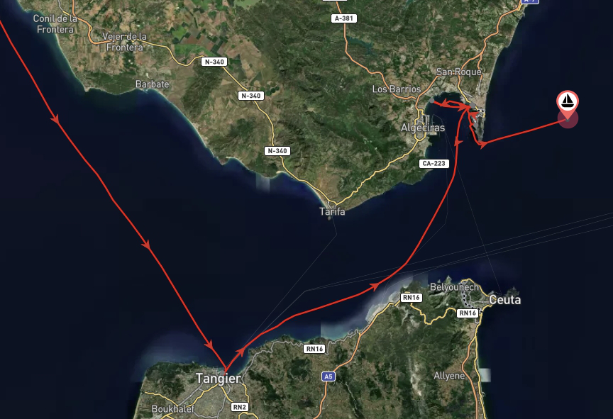
Choose a day with a light Poniente (westerly) or a nearly windless forecast – remember that the Strait is always windier than the forecast might indicate. You should NOT attempt to make this journey with a strong westerly wind as you will be facing a sharp increase in wind speed off Tarifa. Be prepared to reef before reaching Tarifa and at the entrance to the Bay of Gibraltar as winds can accelerate massively at these points.
Staying close to the European side
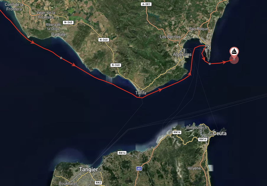
Options for departing port: there is a good selection of ports along the Spanish coast in which to wait for a weather window. Eastbound sailors generally wait at Barbate as it is the last marina before the Straits and only 20NM from Tarifa. Others prefer waiting for a weather window at anchor, further north in the beautiful towns of Cadiz or Rota.
Tide: aim to arrive at Tarifa at slack water (HW-GBR). You know your boat, so be realistic about your likely speed over ground, and pay close attention to the predicted currents along your planned route. For us on a 44ft monohull, this meant leaving Barbate 3 hours before HW-GBR; giving us a great sail around this rather notorious headland.
Staying close to the African side
This is a practical option for boats sailing from The Canaries into the Mediterranean Sea. It is also a good option for boats wanting to stop at Tangier to explore Morocco or for non-Shengen crew needing a break from visiting the EU.
Boats taking this route follow the current along the African coast and either stop in the Spanish enclave of Ceuta or turn north (towards Spain or Gibraltar) just before reaching Ceuta.
- Options for departure port: Tangier has a modern marina and is also a port of entry.
- Tide: leave Tangier 2 hours before HW-GBR as the current begins to flow east.
Westbound transit – leaving the Mediterranean
Leaving the Mediterranean, passages are trickier since westbound tide windows are much shorter than eastbound. Choose a day with a light Levante (easterly) forecast, and bear in mind that the wind will accelerate dramatically when approaching Tarifa. Remember to look out for a cloud covering the Rock, indicating a Levante is blowing.
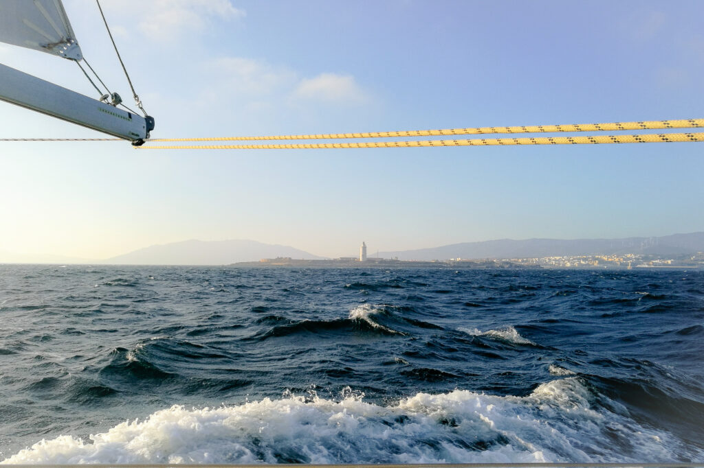
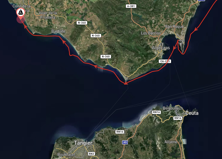
Staying close to the European side
- Options for departure port: there are many marinas and anchorages in the Bay of Gibraltar where you can wait for a favourable weather window. Gibraltar or the Alcaidesa Marina in La Linea are favourites among the sailing community and are only 15-17NM from Tarifa.
- Tide: plan to reach Tarifa 6 hours after HW-GBR to make the most of westerly tidal current.
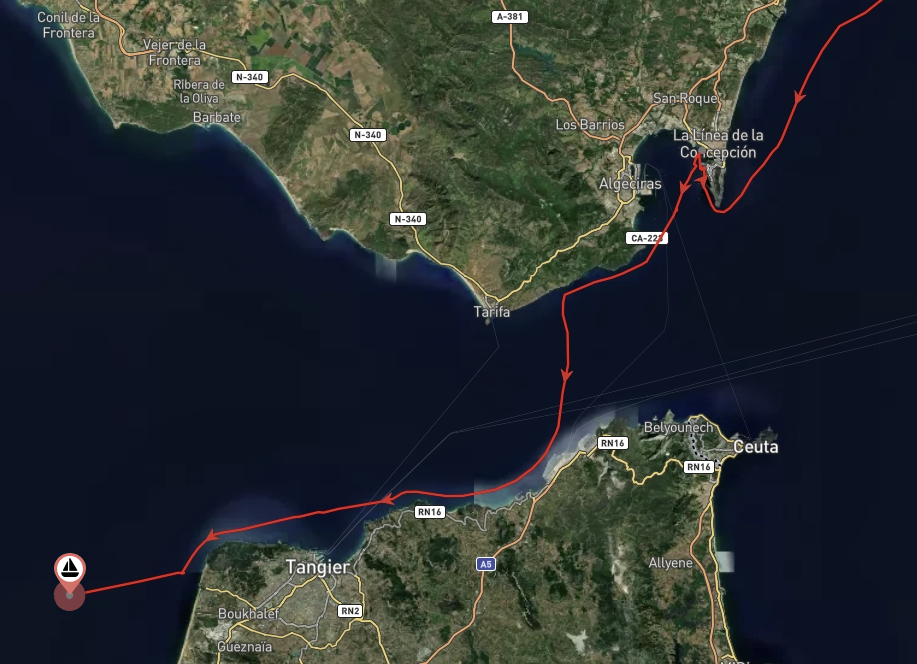
Staying close to the African side
When heading south out of the Mediterranean, perhaps to start an Atlantic passage, many boats choose to cross the Straits at their narrowest point. This has the advantage, not only of ensuring less time spent in shipping lanes, but also in deeper water making orca encounters less likely.
If you are departing from the European side of the strait, you should plan your journey to cross the TSS during slack water and then catch the current flowing west.
- Options for departure port: this is difficult as there is very little choice along the African coast. The Spanish Enclave of Ceuta is the preferred marina for many to wait for a weather window, but others start their passage from Gibraltar or Alcaidesa.
- Tide: slack water is at 2 hours after and 4 hours before HW-GBR, and the current sets to the west between these times.
Contribute to the knowledge
Have your transited the Straits of Gibraltar? Then open the transit markers on noforeignland (transiting east and transiting west), and add a review summarising your passage plan and how it worked out for you.
Helena, and her husband Steve, have lived aboard their Hallberg Rassy 43 Amalia since 2014 and have sailed extensively in the Mediterranean and more recently the Caribbean, the east coast of the United States, and Central America.


Dank voor deze duidelijke beschrijving.
wij hebben het voornemen om over 1 á 2 jaar de straat de passeren west naar oost. Deze informatie pas goed in onze tocht voorbereiding.
—
Thank you for this clear description.
We intend to pass the straits west to east in 1 to 2 years. This information fits well in our trip preparation.
Thank you, very informative. Colin Thomas also wrote some excellent guides on the subject. Unsure if they are available online but he is on FB.
Thanks Helena – great info..last time I sailed into Gibraltar from the UK 20 yrs ago …now we will be sailing out from Gibraltar
Cheers Dirk