If you want a more accurate track for your boat’s journey then this article tells you all you need to know.
How is a journey built?
Your journey on noforeignland is like a game of join-the-dots. Every time you submit a position report, the following information is recorded:
- Your position (latitude and longitude).
- The time you were at this position.
- And optionally, the path you took to reach this position.
Simple tracking systems, like Iridium GO! or adding a manual boat position update, only submit your position and time. The resulting track that gets drawn on the map is therefore just a series of straight lines that connect the locations reported, starting with the earliest time and ending with the latest.
More complex tracking, like the noforeignland app for example, submits your position, the time at which you were there, and also the path leading you there. This means that the lines joining the dots are no longer straight, but are drawn with great accuracy.
Advantages of using a tracking system that submits a path are:
- A much more accurate record of your journey.
- Accurate mileage calculations.
- You can add stories at precise locations along your track.
- Much less likely to ever see your track cross over land.
Your boat may sometimes appear to cross land when you are using a tracking system which does not include path data. This can occasionally happen with systems that submit path data too when there are GPS or timing errors in a recording.
In either case, the good news is that you can manually edit the path to a fix on our web site. For technical reasons it is not possible to provide this functionality in our app.
Top tip: Editing a path can be fiddly so we always encourage people to use a laptop rather than a phone or tablet.
How can I edit a path to a position fix?
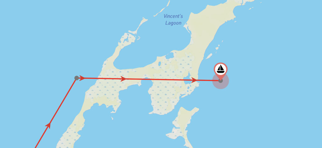
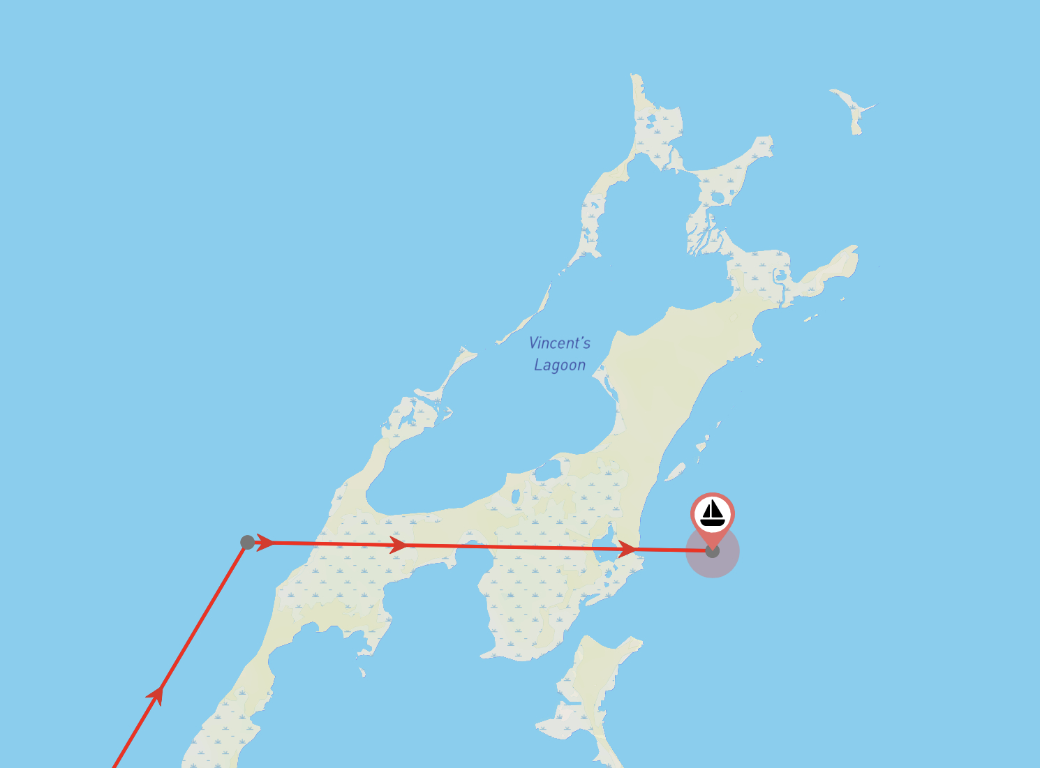
Let’s look at the steps required to edit this boat’s journey where it cuts across an island:
1. Sign in to our web site
Before you start, make sure you are signed in to your account on our web site. If you normally use our app, then be sure you access the same user account by signing in using the same method (i.e.. Google, Facebook or Email/Password).
2. Show your boat’s journey and locate the fix you want to edit
In the picture above, the straight line that crosses land leads to the last fix in our boat’s journey, which runs from west to east across the map. We can see there is no path data as the fix dots have been connected using a straight line.
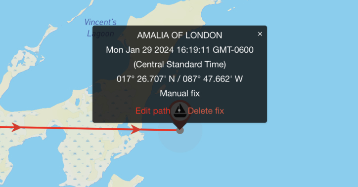
Zoom in on the map so make sure the fix dots are visible, tap on the fix at the end of the line and choose the Edit path option:
3. Edit the path’s shape
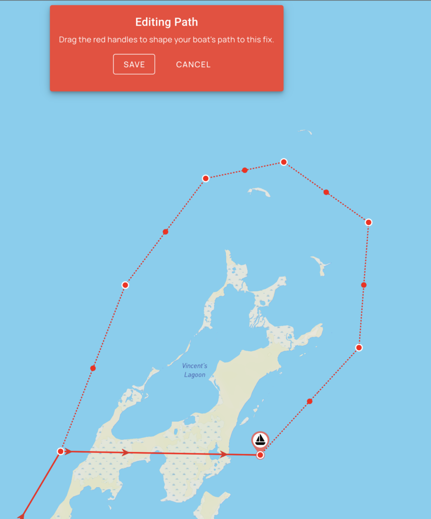
After selecting Edit path, red handles will appear along the line leading to the fix. Drag these handles to reshape your path. As you reshape the line, more drag handles will appear, allowing you to create a very accurate shape. When you are happy with it, press the SAVE button to save your changes.
4. Admire your new track!
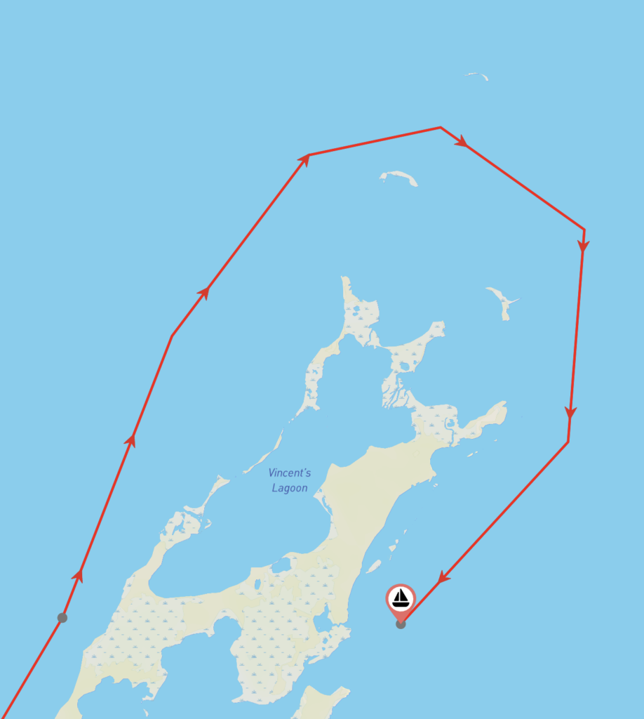
Now, when anyone views your boat journey they will see the corrected path:
Can I delete a position fix?
If you need to delete a fix, then follow step 2 above and selecte the Delete fix option from the popup menu instead of Edit path. The fix, and the path leading to it will be permanently deleted.
Conclusion
Tracking systems that submit path information are more accurate than those that do not, but both can make mistakes; this is especially noticeable in areas where your track is required to weave around obstructions like islands or around bends in rivers.
In cases where your track does not look good, the noforeignland web site provides a simple mechanism that allows you to manually reshape it.



This is VERY helpful! Thank you! Thanks for including this option to fix what is there.
You’re welcome, All tracking systems are prone to some degree of error, so this is a very popular feature. I’m glad you found it useful.
How do you delete a track or a fix?
Hi Francesco. That’s a good question. I added a section to the end of the article explaining how to delete a position fix.
Hi Steve. Thanks for your article. I noticed that after editing a very, very long track (sone 10,000 miles–actually a GPX import of my track from Following Sea), the starting fix seems to be “brought forward” by the amount of miles you tweaked the track to be more accurate. In other words the total distance of the track, at the time of editing, stays the same.
There’s nothing in the code that will move the fix position so I can’t see how this is possible. To check, I just tried this on a 20,000 NM track in a test environment and it worked as expected – i.e. I edited the shape of the track and the mileage sailed in that period changed, and the position fix remained in the correct place. If you can capture this on video and email it to us a support@noforeignland.com we might be able to see what’s happening.
Hi Steve. Ok then, it might be some other cause. It’ll be time consuming to reproduce as I need to delete everything (my original 10,000 NM import and all subsequent updates in additional tracks) and redo it.
Ok – thanks for letting me know. Like I said, I did test it and it looks like it’s working correctly to me. You could try making a small edit to your long GPX import and check it updates properly if you’re concerned.
Hi Steve,
wondered if it is possible to add manually a track that we had prior discovering NFL?
standing by
Brad
Hi Brad,
Yes you can. I’ll be publshing an article in the next few days detailing the options for doing just this.
Steve.
Hello Steve,
thank you for explanations. But how to delete a fix that is not visible on the map? I got one from an import from the predictwind data hub, far up in the north – or maybe on the moon. How to get rid of it?
Kind regards
Martin
If it’s a fix, then you’ll see a grey dot which when tapped on can be deleted (see the dialog in the image in section 2).
If there’s no grey dot then it’s not a fix, it’s part of a path to a fix. From what you’re asking, it sounds like PredictWind Datahub has recorded an incorrect location in your track which now forms part of the path to the fix.
Tap on the first fix you can see after the point that took you to the moon, and edit the path to it as described in this article. You can then drag that point to a more sensible location.
I hope that helps. Let me know!
When I go to edit the journey as described in the article, I do not see the option to save the edits – quite frustrating. I an using Win 11 and edge as the browser. Any thoughts as to what may be wrong
Hi Peter. There should be a red dialog shown at the top of the page, as can be seen in step 3 of the article.
If you cannot see this, then perhaps try using Chrome or Firefox and see if that works. It’s just me writing the code, and I don’t have the resources to test this on every combination of OS and browser. I just tried editing our boats track and it all works as described for me using Chrome. If you still have problems, then send some us screenshots with more details to: support@noforeignland.com, and we’ll look into it.
The delete option is not showing up for my. I can edit and change points, but not delete !?
That shouldn’t be possible, the edit and delete menus are only ever shown together. Are you sure you are signed in to an account that is registered as crew on your boat? If so, please send a screenshot to us at support@noforeignland.com and we’ll help you.
Hi Steve. Is there a way to export a track from Noforeignland? I am making map art using a GIS program of our trip and want to be able to export our track as GPS files. Thank you.
Hi Michelle. No we don’t provide an option to do this yet.
Hi Michelle. We’ve now added a GPX export for boat tracks. Take a look in your boat settings in the app, you’ll see it there.
Hello Steve, thanks for the information. But when I tried to follow your steps to click the fix dot at the end of my journey, I never see options of black background screen, which shows edit, delete or manual fix. Why? If I double click the fix dot, it only shows my boat details. Can you please advise how to fix this?
By the way, I am using the Firefox. I tried Chrome at first, but the webpage couldn’t be opened.
Hi. It does work as described in the article. Try reloading the web page, then if it still doesn’t work for you, send some screenshots and an explanation of what you’re doing to support@noforeignland.com.